Around Svalbard
June 7th to August 20th - 2013

The Route
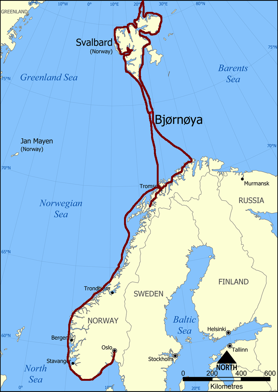
Getting to Tromsø
As the start of this expedition around Svalbard was in Tromsø, we had to move the boat from it's home port in Tønsberg, up there in the start of June. During this transportation, along the norwegian coast, we had some great moments.
Sailing to Bear Island
Before leaving, the crew onboard, Bent, Catrine, Marselius, Stig and Stein filled up the boat with pretty much all the food that was needed for the trip. Since the only place to buy food was in Longyearbyen, and we didn't know how good the store would be there.
When leaving Tromsø we went straight out into open seas. This 290 nautical miles, straight north crossing to Bear Island was a somewhat uneventful happening. We had descent winds from the west and sailed pretty much the whole way.
Bear Island:
Bear Island is an island approximately 2/3 of the way between Norway and Svalbard. The island was first discovered by Willem Barents from the Netherlands in 1596. He named the island Bear Island because when they was on their way ashore they saw a polar bear swimming in the ocean. Between 1600's - 1800's the island was used as a base for catching walrus's and between 1915-40 there was a couple of attempts to carry out profitable coal-mining, but it never succeeded. Some of the railroad used to carry the coal down to the ships can still be seen today. As of today there is no permanent settlement on the island, but on the northern part of the island there is a meteorological station operated all year round by up to nine people on six month stay at the time.
When we arrived at Bear Island, we anchored up and made landfall on the southern part. We explored this area before heading up the east coast to Tunheim. This is the last place there was an attempt to bring out coal and where you can see some parts of the railway and other tools left by the coal miners. Here some of the crew went by foot over to the meteorological station while the rest moved the boat around to meet them.
While anchored at Bear Island and due to the big swells we tore off the bow-roller assembly on the port side. Fortunately our boat is equipped with dual bow anchors, so we made due with the one, until we could get it repaired when arriving in Longyearbyen.
Seeing Spitsbergen for the first time
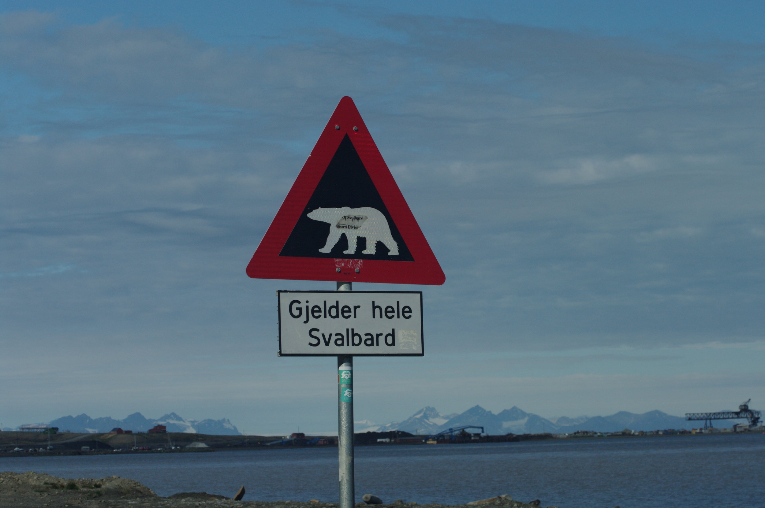
After leaving Bear Island there was an easy 130 nautical mile sail to the southern point of Spitsbergen where we made landfall. After loading the guns (there's a law on Svalbard that a gun must be carried outside Longyearbyen due to protection from polar bears) we had a celebratory drink.
Spitsbergen:
Spitsbergen is the largest island in the island group of Svalbard. There is approximately 2600 residents on the island, most of them living in Longyearbyen. From 1906 all the way up to 2000 there was coal mining on the island. The world seed vault is also located on the island, this seed bank holds up to 4,5 million duplicate samples of seeds held in gene banks all over the world.
After we had celebrated the successful crossing, we headed up the west coast towards Longyearbyen. On our way there we stopped by the Polish Polar Station in Hornsund to take a look. Before we arrived in Longyearbyen we swung by a glacier, where Catrine got to try out her kayak.
Doing touristy things
We arrived at the harbor in Longyearbyen with three new crew members, Atle, Siri and Lars waiting at the dock. The first thing we did, was to go over the boat to see what needed repair. Stein and Lars started to fix the broken bow-roller while the other tidied up other stuff around the boat.
After everything was back up and running, we started on a 4 day cruise in the fjords around Longyearbyen. We started out sailing into a glacier before heading ashore to go for a hike. Thereafter we sailed into the Pyramid where we got an unexpected guided tour by one of only a few people living there.
Pyramid:
The Pyramid is an abandon Russian mining town that lies in the end of Brillefjorden. It was Sweden that founded the town in 1910, but sold it to the Soviet Union in 1927. In 1998 the last coal was extracted and shortly after the town was abandon. For the next 9 years the town was basically a ghost town, before the Russian mining company decided to renovate the old hotel and make the town into a turist attraction.
Trapper Station and Ny-Ålesund
After sailing the fjords around Longyearbyen, two of the crew, Stig and Siri traveled home and Knut, a new crew member flew in and joined us for the circumnavigation of Svalbard.We set sail and headed north, up the west coast of Spitsbergen. Our first port of call was Farmhamna.
Farmhamna:
Farmhamna is a trapper station located just north of the entrance of Isfjorden, approximately a 42 nautical mile sail from Longyearbyen. This is one of only three remaining trapper station privately run. The requirement to be in possession of a trapper station on Svalbard, is that you have to use it to conduct commercial winter hunting. That means that you can't use it as a cabin, but you need to make a living of the property.
Next up was Ny-Ålesund. This was a 50 nautical mile sail further north.
Ny-Ålesund:
Ny-Ålesund is one of the most northerly settlements in the world at 78°55'0"N. The town was established i 1916 to support the mining of coal around that area. The mining operation was closed down in 1962, and today the town's function is a base for international arctic research. In the town's earlier days, it was also used as a base for many arctic expeditions and attempts to reach the north pole. Ny-Ålesund also has one of the most northern post office.
Virgohamna, a failed expedition
After leaving Ny-Ålesund we wouldn't be in a town until we got back to mainland Norway. We checked over the boat one last time, and headed out. First stop was Kongbreen, which is a glacier that stretches all the way down to the ocean. While we where there, we witnessed big ice-chunks separate from the glacier.
We continued north and anchored up in Virgohamna, which has some interesting history.
Virgohamna:
Virgohamna was a Dutch whaling station back in the 1600's. But in 1896 the swedish engineer, Salomon August Andrée, used the place as a startbase for an attempt fly to the north pole in a hydrogen balloon. They made hydrogen by mixing iron filings and sulfuric acid. You can still see piles of iron filings in the area. The expedition was a failure. After taking of, they lost their means of steering and the balloon went down at 82° 56´ N. They tried to get back to civilization, but one after another they died. Their bodies and diaries was found 30 years later on Kvitøya, by the Bratvaag-expedtiton
Hiking between two fjords
As the days go by and not being able to move much, except around the boat, part of the crew, Atle, Knut, Catrine and Bent, decided to hike over a mountain, between two fjords. While Stein, Marselius and Lars moved the boat around to meet them.
Hot springs on Svalbard?
As we had great success with the hot springs on Greenland two years earlier, we where exited to hear that there is a hot spring on Svalbard as well. But after a couple of hours of walking we where quite disponent. Although the pond held a nice 24°C, it was only big enough for four sets of feet.
Running aground
We are in this nice lagoon called Claravågen at 80°N. The previous day we went through the narrow opening with no problem. But on this particular day, the worst happened. Lars is at the helm, Bent is videotaping, Catrine is on top of the pilothouse. Due to the outgoing current we are doing 9-9,5 knots. We're following the inbound track from the day before. Then suddenly a BIG boom. The boat raises up of the water on her keel, it balances for a couple of seconds before she falls over on her starbordside. We had hit a shallow or rock that only lay half a meter below sea-level.
After a couple of minutes with a slightly panicking atmosphere onboard while we checked for leaks, we starte to work on getting her of the rock. We tried literally everything. Hoisting the tender in the mast to leverage the boat even more over. Furling out all the sail. pulling the mast sideways with the tender. Our last resort was to attach a line to the bowsprit, to try and twist her of. The only bad thing doing that, is that we risk damaging the rudder. But with the tide working with us, and carefully twisting her with the tender we go her of. The only damage to the boat was a fist sized dent in the keel.
Later after checking the track on the computer, we saw that we where approximately 2 meters of to port. Keep in mind that this is uncharted waters.
Swimming at 81°N and Walrus's
One the places we wanted to visit was Sjuøyane, which is a group of island's located north of Nordaustlandet.
Sjuøyane:
The island consist of seven islands with Rossøya being the northernmost, making it the northernmost place in the kingdom of Norway. The biggest island of the group is Phippsøya, which houses a big colony of walrus's.
We where making our way north past Sjuøyane and up to 81°N. Our hope was that we could make it to the icecap of the north pole. But at 81°N we couldn't see it, and estimated that it would take us at least one day to reach it. Instead we choose to check out the bathing temperature of the water by jumping in. It was a freezing -1,8°C.
After the refreshing bath, we headed back south to Isflakbukta by Phippsøya where we were greeted by a group of walrus's. We went ashore to look at these fascinating creatures.
The next day, we went for a hike up Høgberget which stands 405 meters above sea level.
Polar Bears!
We had been on Svalbard for many weeks, without seeing a singel polar bear. One day we made landfall, and we saw some footprints on the beach. I our binoculars we saw something that looked like a white rock further inland. We decided to go for a closer look. The closer we came, the more sure we got that this was a polar bear. We where walking against the wind, so the bear couldn't smell us. We sat down in a safe distanse, when suddenly the bear stood up and we could see that it was a mother with two cubs. We spent an hour just watching the animals.
Iceberg ahead
Moving the boat around the east side of Nordaustlandet was quite the uneventful happening due to thick fog. We entered the south end of Hinlopenstredet and saw this big isberg floating there, this had to be checked out.
Strong currents and a burger bar
Heleysundet is a narrow passage between Spitsbergen and Barentsøya. Its known for its strong currents, and in the earlier days many ships has been screwed down by drift-ice packing them in the sound.
For us the passage thru went fine, due to some calculations made before we sailed there, so we pass thru when the currents was at its weakest
We met up with S/Y Alaska and invited them over to some homemade burgers and buns.
Back to the mainland
After finishing up our circumnavigation of Svalbard it was time to head back to mainland Norway, and back to our normal life. The passage from Svalbard via Bear Island went without a hitch. We arrived in Hammerfest early in the morning, and walked the city until the shops opened. Knut flew home from there, before we started sailing over to Sørøya. On this island we went on a hike over to Nordsandfjorden to take a look at the caves in the mountainside.
Nordsandfjordhula:
The cave opening faces the sea and can be hard to find. Once you find it, it's relatively easy to get in there, but the rocks are full of seaweed and can be slippery. This cave was used by the families from Sørøya during the end of WW2. In early November, 133 people had sought shelter in the big cave from the German forces. But only two weeks later they where found and ordered to leave the cave
After visiting Sørøya we headed to Tromsø. Once in Tromsø Marselius and Catrine flew home, while the rest sailed on towards Andørja. Andørja has the highest mountain on an island in Scandinavia at 1276 meter above sea level and Lars and Bent decided to go for the long climb. After this we sailed to Harstad where Lars flew home and Bent, Atle and Stein moved the boat to Bodø where she would stay until the next sailing season.